Free classroom and publishing assets
Download charts built to be cited.
Each 1600×900 chart carries its own source, definition and limitation note. Download PNG for slides and articles or SVG for sharp printing and accessible resizing.
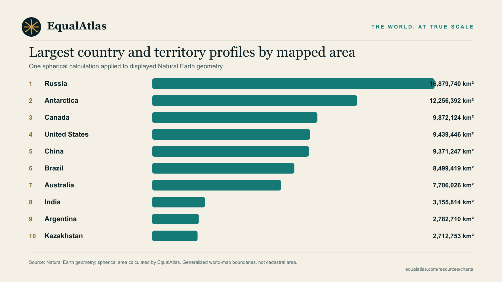
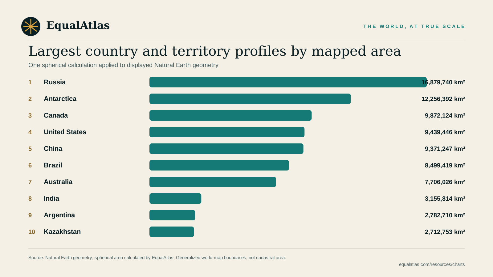
Largest profiles by mapped area
Ten country and territory profiles measured from the same displayed Natural Earth geometry.
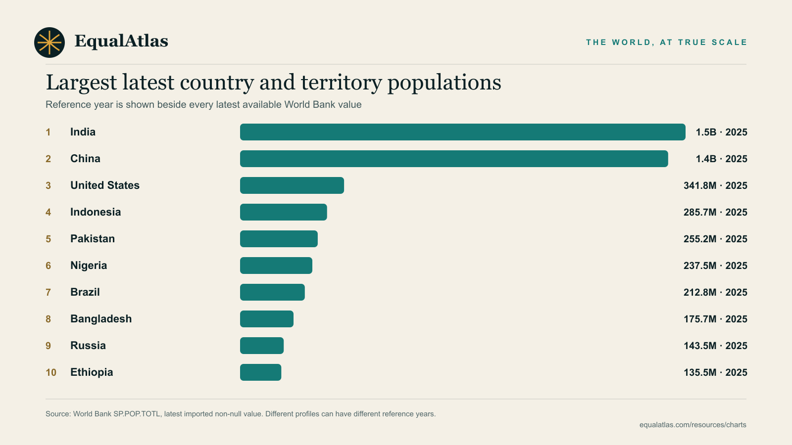
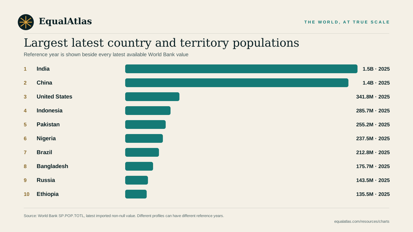
Largest latest populations
Ten World Bank population values with each profile's reference year printed beside it.
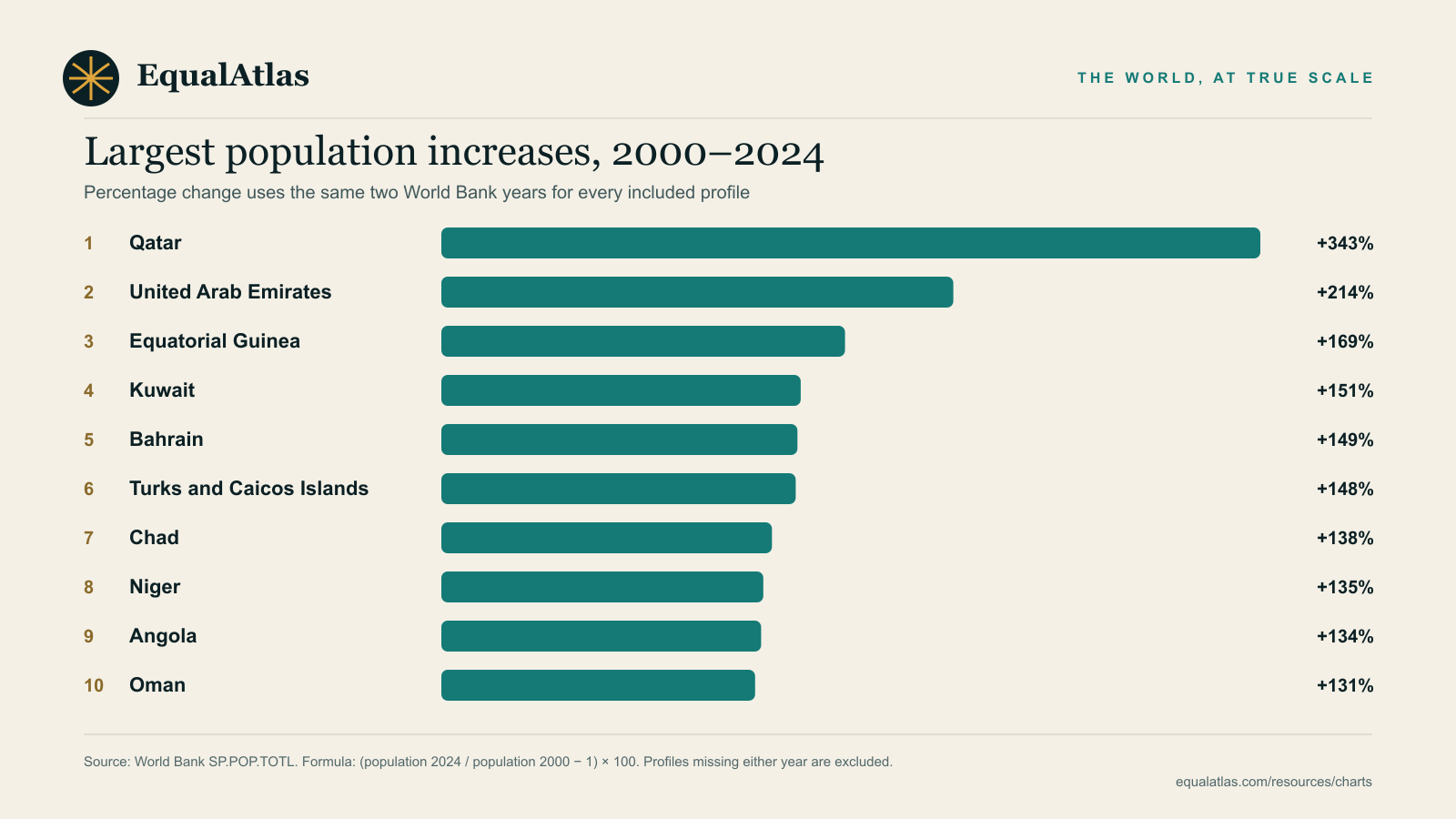
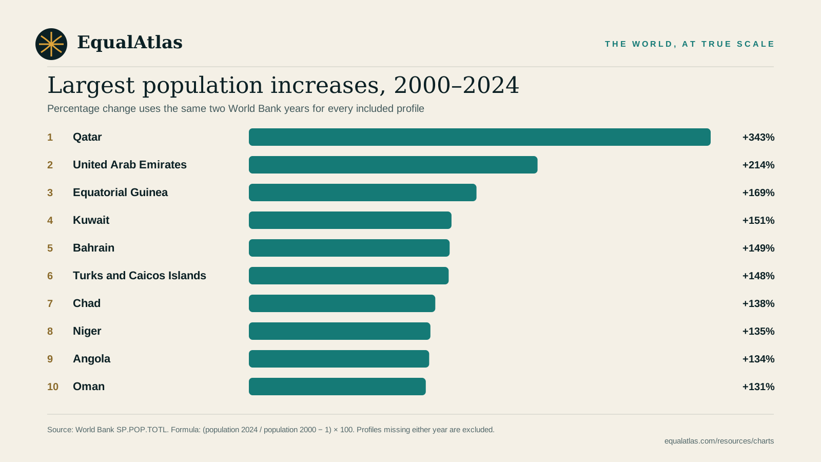
Largest population increases, 2000–2024
A reproducible same-year percentage ranking that excludes profiles missing either endpoint.
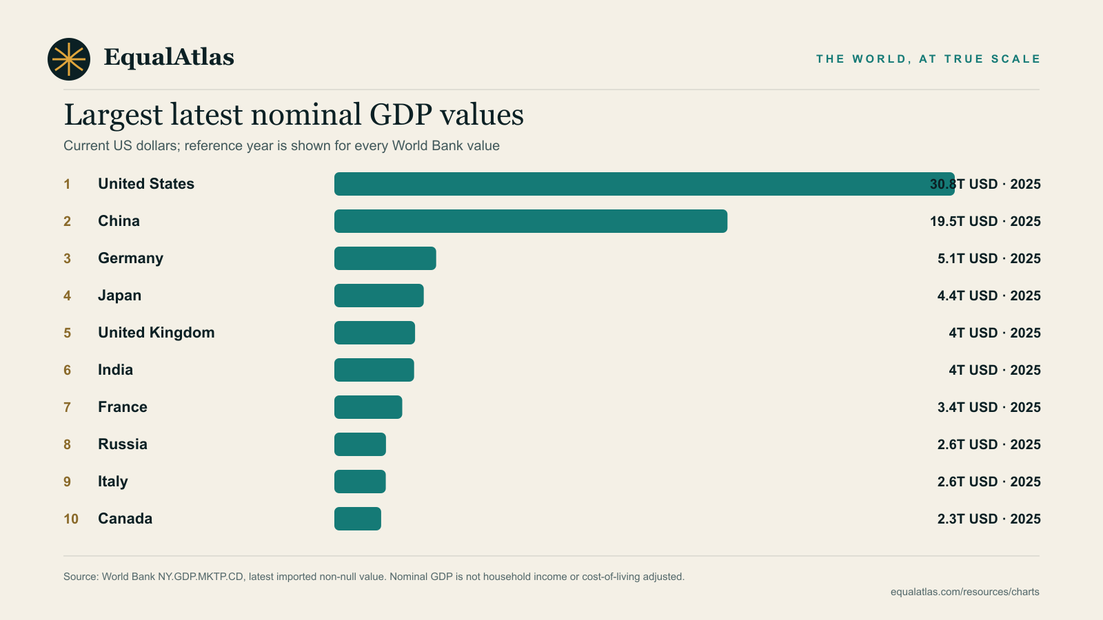
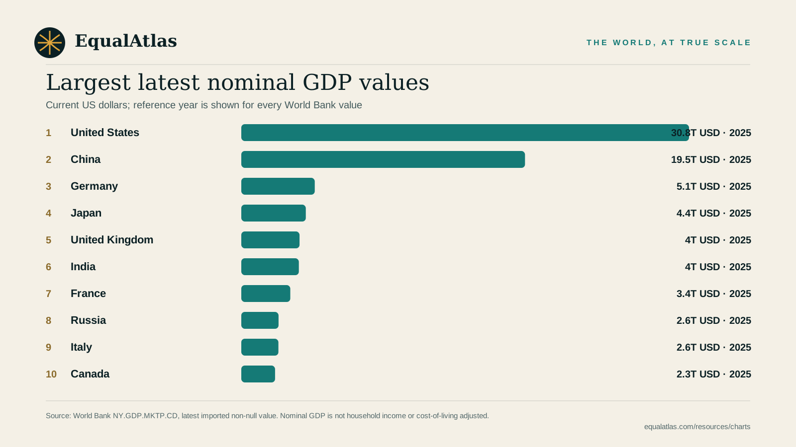
Largest latest nominal GDP values
Current-US-dollar World Bank values with visible reference years and an interpretation warning.
Reuse and attribution
The charts are free to use in lessons, presentations and articles with visible EqualAtlas attribution. Preserve the source footer and the original Natural Earth or World Bank attribution. Download the asset README for the concise reuse note.
Need the underlying rows?
Use the CSV and JSON downloads for analysis, then follow the citation guide so values, years and definitions remain reproducible.